

Mead Valley Metrolink Station/Mobility Hub
Pre Construction
Status: Pre-Construction
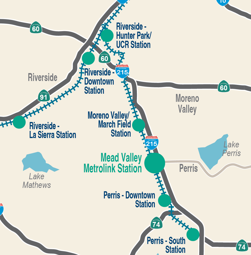
Location: Mead Valley, 91/Perris Valley Line between Moreno Valley/March Field Station and Perris-Downtown Station
Type of Project: Rail Station Improvements
Location: Mead Valley, 91/Perris Valley Line between Moreno Valley/March Field Station and Perris-Downtown Station
Investment: Estimated $50.5 million (environmental, design, right-of-way, construction)
OVERVIEW
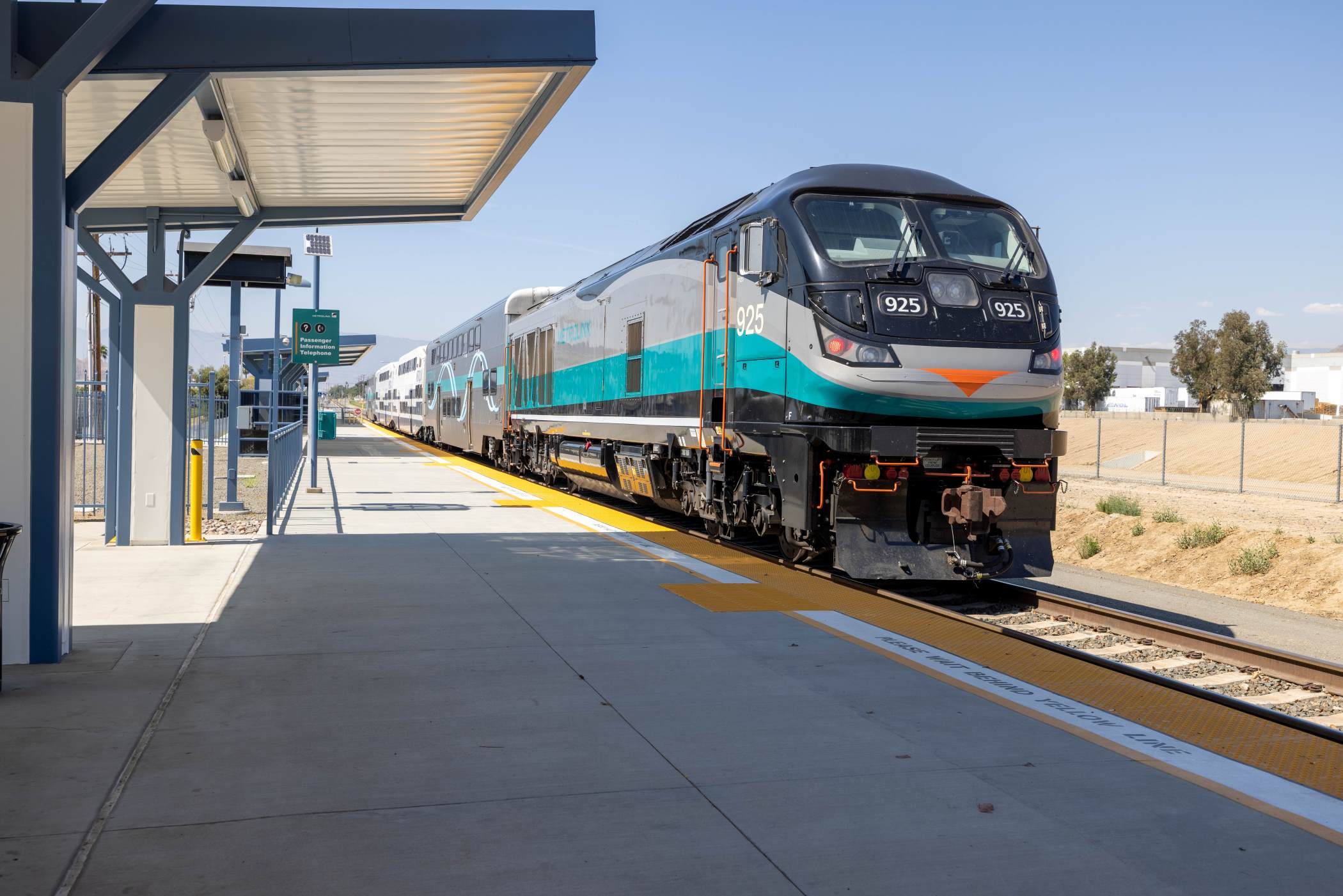
RCTC in partnership with the Southern California Regional Railroad Authority (Metrolink) are proposing the Mead Valley Metrolink Station/Mobility Hub Project to serve the existing Metrolink 91/Perris Valley Line in the unincorporated community of Mead Valley in Riverside County.
The new station will:
- Improve the transportation system
- Provide alternate travel choices
- Promote community and transit-oriented development
- Minimize adverse environmental impact by taking cars off the road
- Invest and deploy resources effectively and efficiently to disadvantaged and growing communities along the I-215 corridor and Ramona Expressway
The Mead Valley Station/Metrolink Mobility Hub Project will provide residents and employers with transportation infrastructure that will alleviate traffic congestion along the I-215 and major roadway corridors in the area.
The final design for this $50.5 million project is anticipated to begin in 2025 and is estimated to be completed by 2029.

91 Eastbound Corridor Operations Project
Pre Construction
Status: Pre-Construction
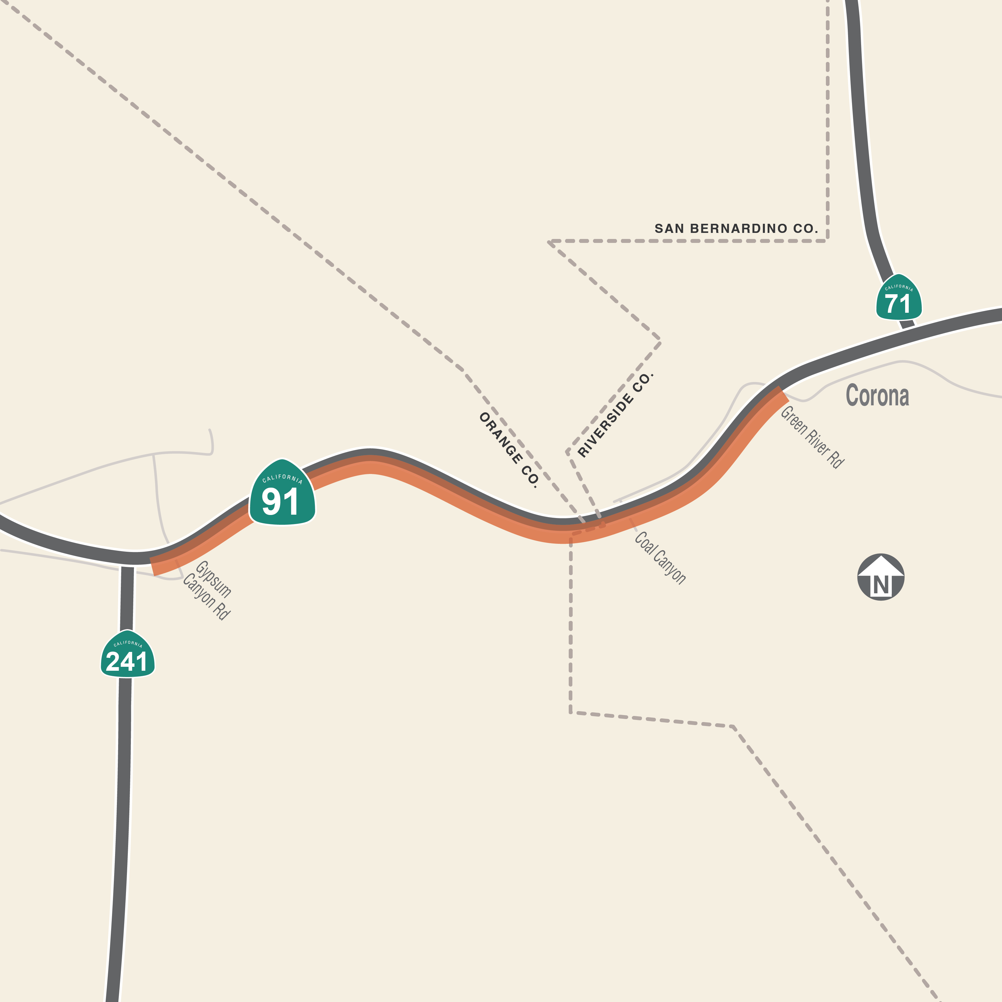
Location: Eastbound State Route 91, from the 241 Toll Road connector to State Route 71
Type of Project: Highways
Location: Eastbound State Route 91, from the 241 Toll Road connector to State Route 71
Engineering/Environmental Studies: Expected to be complete by fall 2026
Construction: Could begin as early as 2028
Investment: $178 million (estimate for design and construction)
OVERVIEW
The Riverside County Transportation Commission, in coordination with Caltrans, the Orange County Transportation Authority, the Transportation Corridor Agencies, and the City of Corona, will add a lane to eastbound State Route 91 from the 241 Toll Road connector to State Route 71 in Corona. The new lane is intended to help improve traffic operations on eastbound 91, especially during afternoon and evening hours.
Improvements also include:
- Widening two bridges
- Constructing retaining walls
- Rockfall mitigation measures
- Replacing overhead signs for better visibility
- A new two-lane exit ramp at Green River Road
The project is currently in the environmental revalidation phase, which is expected to be completed in fall 2026. RCTC is anticipated to award a Progressive Design-Build (PDB) contract in late 2026 to design and build the project.
Construction is anticipated to begin in 2028. RCTC anticipates to award a Progressive Design-Build (PDB) contract in late 2026 to
design and build the project.
Construction is anticipated to begin in 2028.
Metrolink Double Track Project: Moreno Valley-Perris
Pre Construction
Status: Pre-Construction
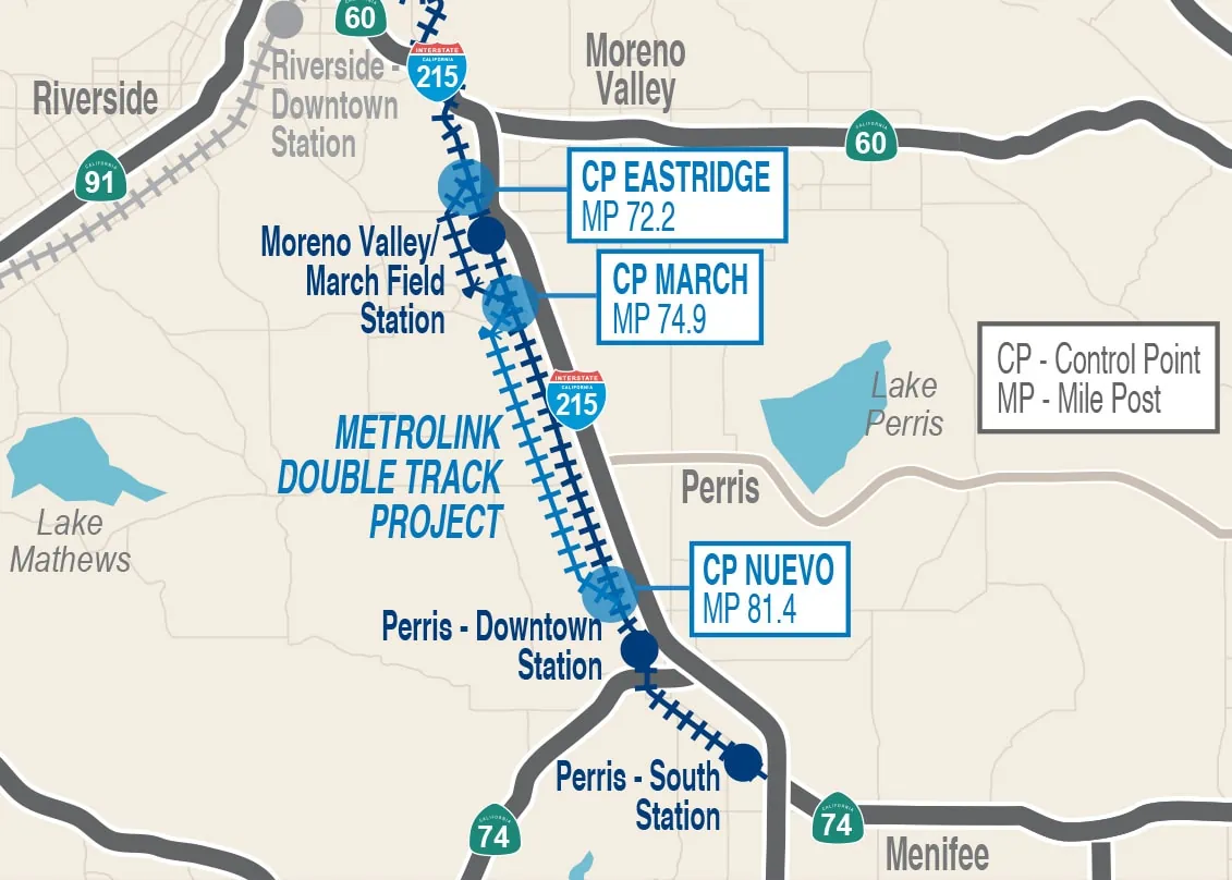
Location: Between Moreno Valley/March Field Station (in Riverside) and Perris-South Station
Type of Project: Rail Corridor
Location: Between Moreno Valley/March Field Station (in Riverside) and Perris-South Station
Construction: Anticipated early 2026
Investment: Estimated $80 million (technical studies, final design, construction)
OVERVIEW
RCTC is completing final design for the Metrolink Double Track Project: Moreno Valley-Perris Project between Riverside and Perris. The project will upgrade 6.5 miles of existing freight railroad track to accommodate passenger rail service between the Moreno Valley/March Field Station and the Perris-South Station.
Once completed, the upgraded track will improve the reliability of Metrolink service, offer an alternative to driving, and help relieve congestion on Interstate 215 by providing reliable and efficient transit options for Riverside County commuters, who face some of the longest commutes in southern California. The project also will increase access to jobs and education in this traditionally underserved area, reduce air pollution, and help Metrolink achieve its goal of providing bidirectional service every 30 minutes in time for the 2028 Olympics and Paralympics.
Construction is anticipated to begin early 2026. The project is a vital component of RCTC’s vision to implement safe multimodal solutions in Riverside County’s rapidly growing communities near Perris. Riverside County is growing faster than any county in California and is one of the fastest growing counties in the nation.
Interstate 10 Highland Springs Avenue Interchange Improvements
Pre Construction
Status: Pre-Construction
Location: Western Riverside County
Type of Project: Interchange
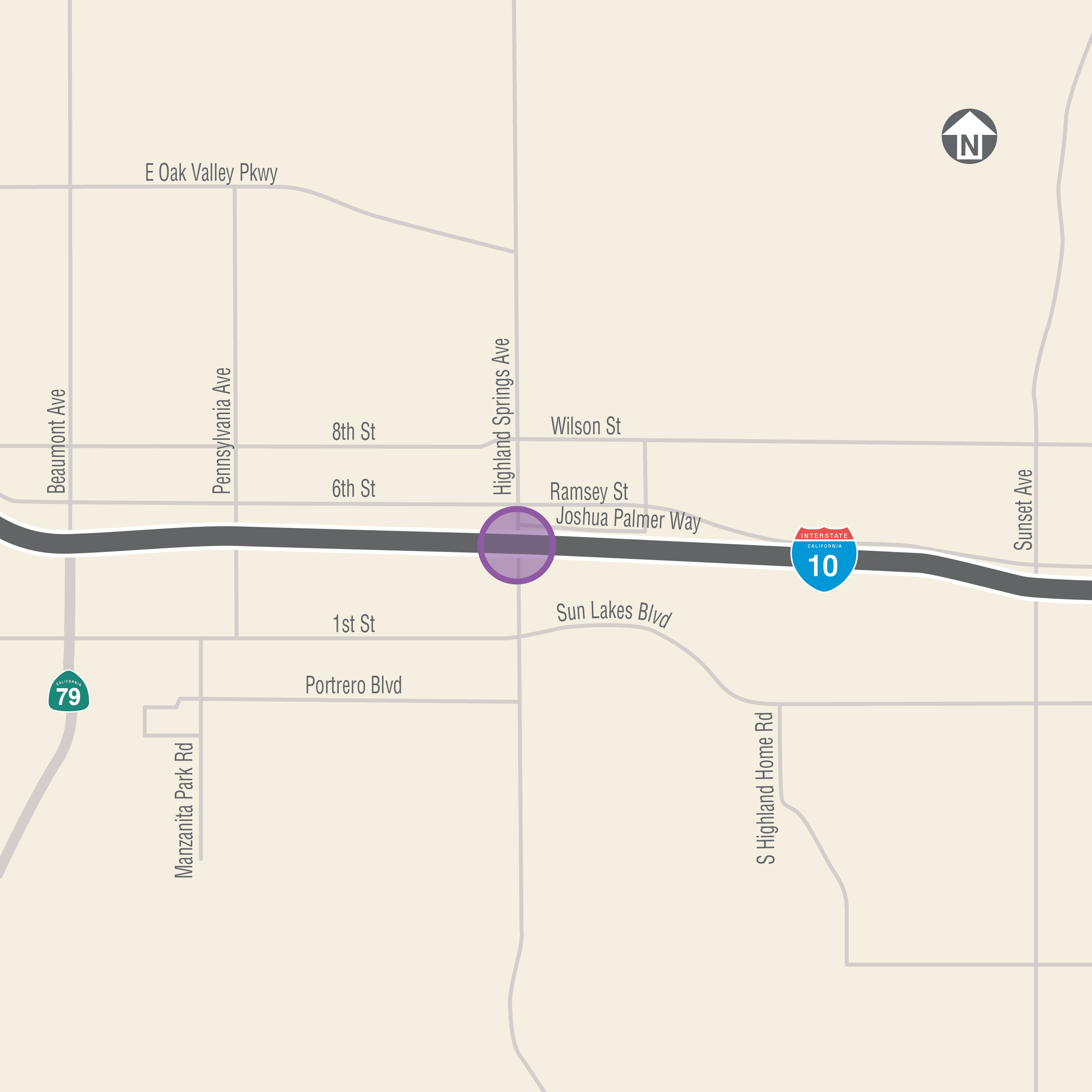
Location: Interstate 10 Highland Springs Avenue Interchange, Beaumont and Banning
Engineering/Environmental Studies/Final Design: Expected from summer 2022 to 2029
Construction: 2030, depending upon funding
Investment: $46 million (construction)
OVERVIEW
The Interstate 10 Highland Springs Avenue Interchange Project, informed by preliminary studies conducted in partnership with Caltrans and the cities of Banning and Beaumont, would reconfigure lanes to the I-10 underpass at Highland Springs Avenue and add merging lanes to the ramps to improve traffic flow and safety.
The interchange serves as the main connection to large housing developments and multiple retail, commercial, medical, and employment centers. With one of the highest peak traffic volumes per hour and per month in Riverside County, it also is in proximity to State Route 60, a major trucking and logistics route for southern California and the nation.
RCTC completed the Project Study Report/Project Development Support document in 2021. Engineering, environmental studies, and final design are expected to be under way from summer 2022 to 2029 Once funding and environmental approvals are secured, construction could begin in 2030. RCTC is seeking federal, state, and local funding sources.
RCTC and project partners hosted approximately 120 visitors during a public information meeting on February 27, 2023, from 5:30 to 7 p.m. at the Albert A. Chatigny Senior Community Center in Beaumont. The meeting was held in an open house format with no formal presentation, but attendees were encouraged to meet the team, ask questions, and provide feedback about proposed design options to be studied by the project team.
If you were unable to attend the meeting, please use the links below to review the meeting exhibits.
- Informational Video
- Welcome Board
- Project Location
- Project Schedule
- Alternative 1 (No Build)
- Alternative 2A (Hook Ramps)
- Alternative 2B (Hook Ramps)
- Alternative 3 (Short Diverging Diamond Interchange)
- Alternative 4 (Long Diverging Diamond Interchange)

INTERSTATE 15 EXPRESS LANES PROJECT SOUTHERN EXTENSION
Pre Construction
Status: Pre-Construction
Location: Western Riverside County
Type of Project: Express Lanes
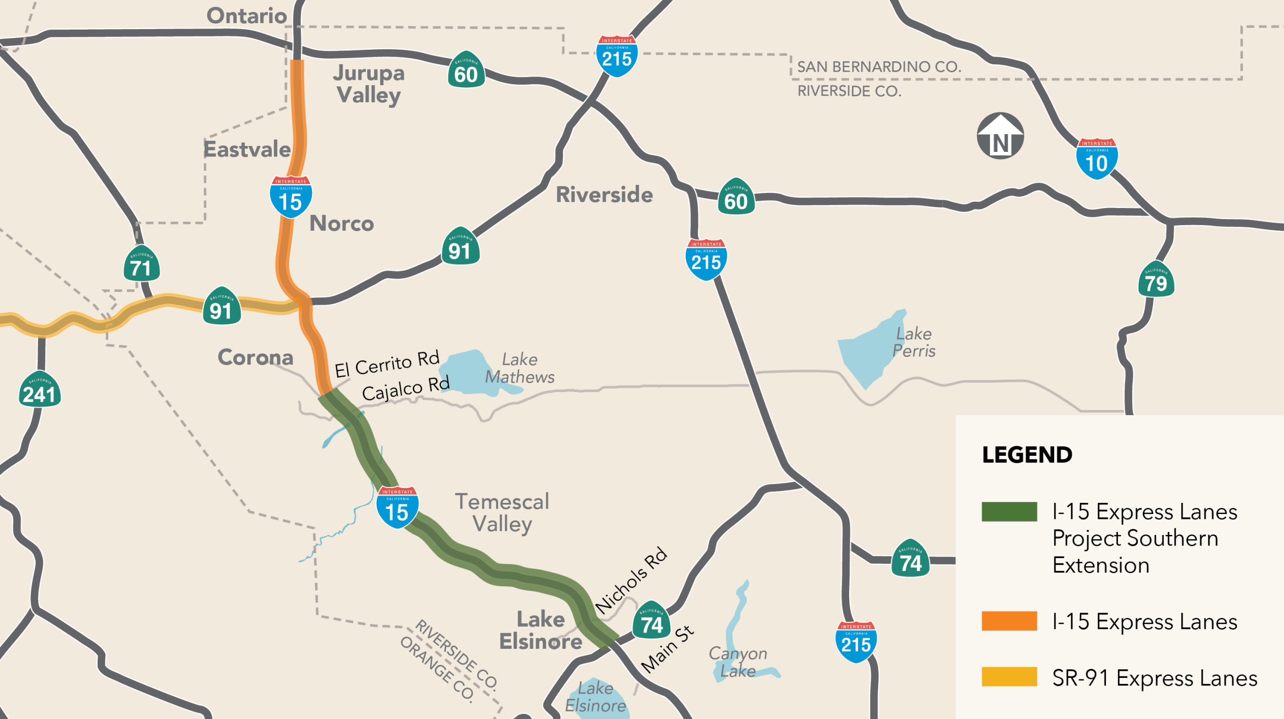
Location: Interstate 15 between El Cerrito Road in Corona and State Route 74 (Central Avenue) in Lake Elsinore
Construction: Progressive Design-Build construction method that could begin in early 2027
Investment: $740 million (estimate for pre-construction, design, construction)
OVERVIEW
The Riverside County Transportation Commission, in partnership with the California Department of Transportation, has conducted preliminary engineering and environmental studies to develop the Environmental Impact Report and Environmental Assessment (EIR/EA) for the proposed Interstate 15 Express Lanes Project Southern Extension.
The proposed project would improve and manage traffic operations, congestion, and travel times along the corridor by extending the I-15 Express Lanes an additional 15.8 miles from El Cerrito Road in Corona, through Temescal Valley, to State Route 74 (Central Avenue) in Lake Elsinore. The project would add two tolled express lanes in both directions within the I-15 median to accommodate increasing traffic volumes in southwestern Riverside County. The project would also add southbound I-15 auxiliary lanes between the Nichols Road entrance ramp and the Main Street exit ramp in Lake Elsinore.
Once built, the project would improve traffic operations and travel times, expand travel choice through carpooling and mass transit, increase travel time reliability, manage long-term traffic congestion, provide a cost-effective mobility solution, and expand and maintain compatibility with the regional Express Lanes network.
Other project features include widening up to 15 bridges, creating multiple express lane entrance and exit points, as well as building noise barriers, retaining walls, drainage systems, and electronic toll collection equipment and signs.
RCTC released the Draft Environmental Impact Report and Environmental Assessment (EIR/EA) for public review and comment on October 9, 2024. The preliminary engineering and environmental process began in May 2019 and is anticipated to conclude in 2025.
Pending project approval, RCTC expects to use a progressive design-build method to expedite the delivery of the project. Construction could begin in 2027, depending on funding availability. The total project cost is estimated to be $550-650 million. RCTC is exploring funding options for construction that may include a combination of federal, state, local, and toll sources.
- First Public Notice – Announcement of Public Hearing for Draft Environmental Impact Report/Environmental Assessment
- Second Public Notice – Announcement Public Hearing for Draft Environmental Impact Report/Environmental Assessment
- Primer Aviso Público – Anuncio de Audiencia Pública para el Proyecto de Informe de Impacto Ambiental/Evaluación Ambiental
- Segundo Aviso Público – Anuncio de Audiencia Pública para el Proyecto de Informe de Impacto Ambiental/Evaluación Ambiental
The public review and comment period on the Draft Environmental Document closed on November 26, 2024.
The technical studies listed below were used in preparation of this Environmental Impact Report/Environmental Assessment.
- Aerially Deposited Lead Analysis
- Air Quality Assessment Report
- Community Impact Assessment
- District Preliminary Geologic Study
- Errata for Value Engineering Revisions
- Phase I Initial Site Assessment
- Jurisdictional Delineation
- Limited Asbestos and Lead Chip Assessment
- Location Hydraulic Study
- Natural Environment Study
- Noise Abatement Decision Report
- Noise Study Report
- Paleontological Identification Report and Paleontological Evaluation Report
- Preliminary Drainage Report
- Project Report
- Traffic Operations Analysis Report
- Vehicle Miles Traveled (VMT) Analysis Memorandum
- Visual Impact Assessment
- Water Quality Assessment Report
- Rapid Assessment of Stream Crossings
- Historic Property Survey Report (available upon request), includes:
- Historical Resources Evaluation Report
- Archaeological Survey Report
- Finding of Effect
Project information boards and videos from the public meetings are available below:
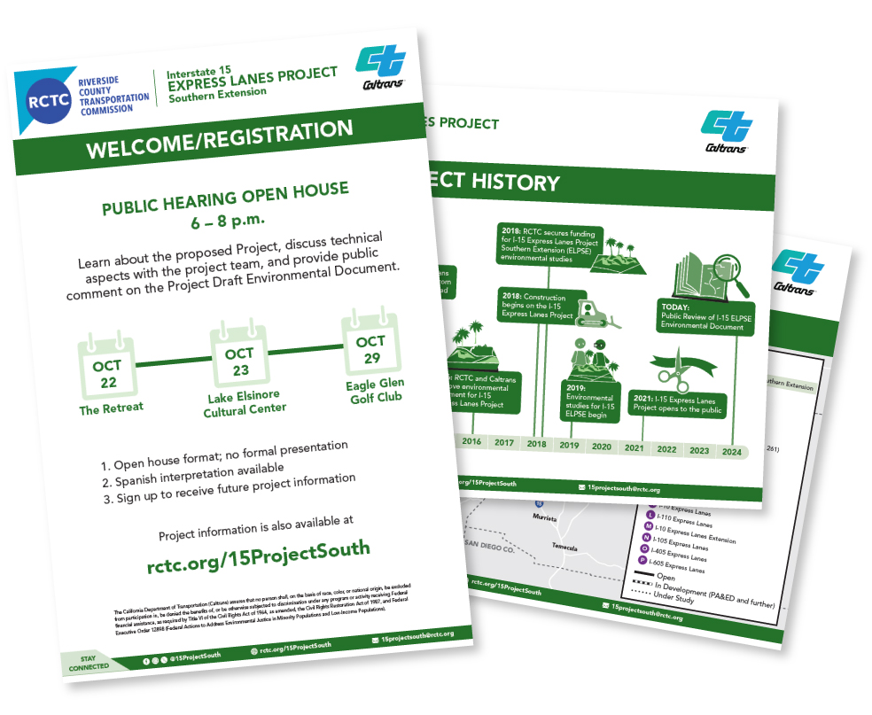
Click on the image above to download the project boards
- 2007: Caltrans approves 45-mile study of I-15 corridor, Route 60 to Murrieta
- 2008: RCTC and Caltrans begin planning studies
- 2009: RCTC receives tolling authority on I-15 from San Bernardino County Line to San Diego County Line
- 2014: RCTC and Caltrans begin studies on I-15 from Route 60 to Cajalco Road
- 2016: RCTC and Caltrans approve environmental document for I-15 Express Lanes
- 2018: RCTC secures funding for I-15 Express Lanes Project Southern Extension (ELPSE) preliminary engineering and environmental studies
- 2018: Construction begins for I-15 Express Lanes Project
- 2019: Preliminary engineering and environmental studies begin for I-15 ELPSE to support Environmental Impact Report/Environmental Assessment
- October 21- November 22, 2019: 30-day public scoping period
- November 12-14, 2019: Public scoping meetings, Temescal Valley, Corona, Lake Elsinore
- 2024: RCTC releases Draft Environmental Impact Report and Environmental Assessment (EIR/EA) for public review and comment, and hosts three open house public hearings
For questions/comments about this project, please respond below.
The environmental phase of work began in 2019, with an anticipated completion date of 2025, due to the complexity of the project corridor, which crosses multiple jurisdictions, widens up to 15 bridges, and may affect numerous waterways.
Pending project approval, RCTC expects to use a design-build approach to expedite the delivery of the project. Construction could begin as early as 2027, if RCTC is able to secure funding. The total project cost is estimated to be $550-650 million. RCTC is exploring funding options for construction that may include a combination of federal, state, local, and toll sources.
- 2007: Caltrans approves 45-mile study of I-15 corridor, Route 60 to Murrieta
- 2008: RCTC and Caltrans begin planning studies
- 2009: RCTC receives tolling authority on I-15 from San Bernardino County Line to San Diego County Line
- 2014: RCTC and Caltrans begin studies on I-15 from Route 60 to Cajalco Road
- 2016: RCTC and Caltrans approve environmental document for I-15 Express Lanes
- 2018: RCTC secures funding for I-15 Express Lanes Project Southern Extension (ELPSE) preliminary engineering and environmental studies
- 2018: Construction begins for I-15 Express Lanes Project
- 2019: Preliminary engineering and environmental studies begin for I-15 ELPSE to support Environmental Impact Report/Environmental Assessment
- October 21- November 22, 2019: 30-day public scoping period
- November 12-14, 2019: Public scoping meetings, Temescal Valley, Corona, Lake Elsinore
Scoping Summary
I-15 ELPSE Scoping Summary Document – Sections 1-5 – Main Body
I-15 ELPSE Scoping Summary Document – Section 6 – Public Comments
Environmental Documents
Public Scoping Meetings
The next opportunity for public comment will be when the Draft Environmental Document is available for review.
Videos from Scoping Meeting

For questions/comments about this project, please respond below.
The I-15 Express Lanes Project Southern Extension Progressive Design-Build RFQ has been issued and is due on April 8, 2025.
For more information, visit PlanetBids here.

Santa Ana River Trail
Pre Construction
Status: Pre-Construction
Location: Western Riverside County
Type of Project: Trails
Location: Western Riverside County
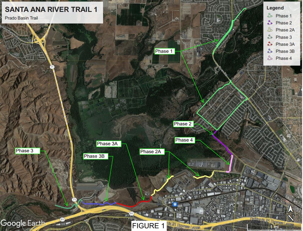
Construction: Phase 4 (between West Rincon Street and Butterfield Drive, east of Corona Municipal Airport) anticipated from 2021 to 2023. Other phases have not been scheduled for construction
Investment: Estimated $35 million for Phases 1-4, including $3 million for Phase 4
Project Status: Engineering and environmental studies are under way
OVERVIEW
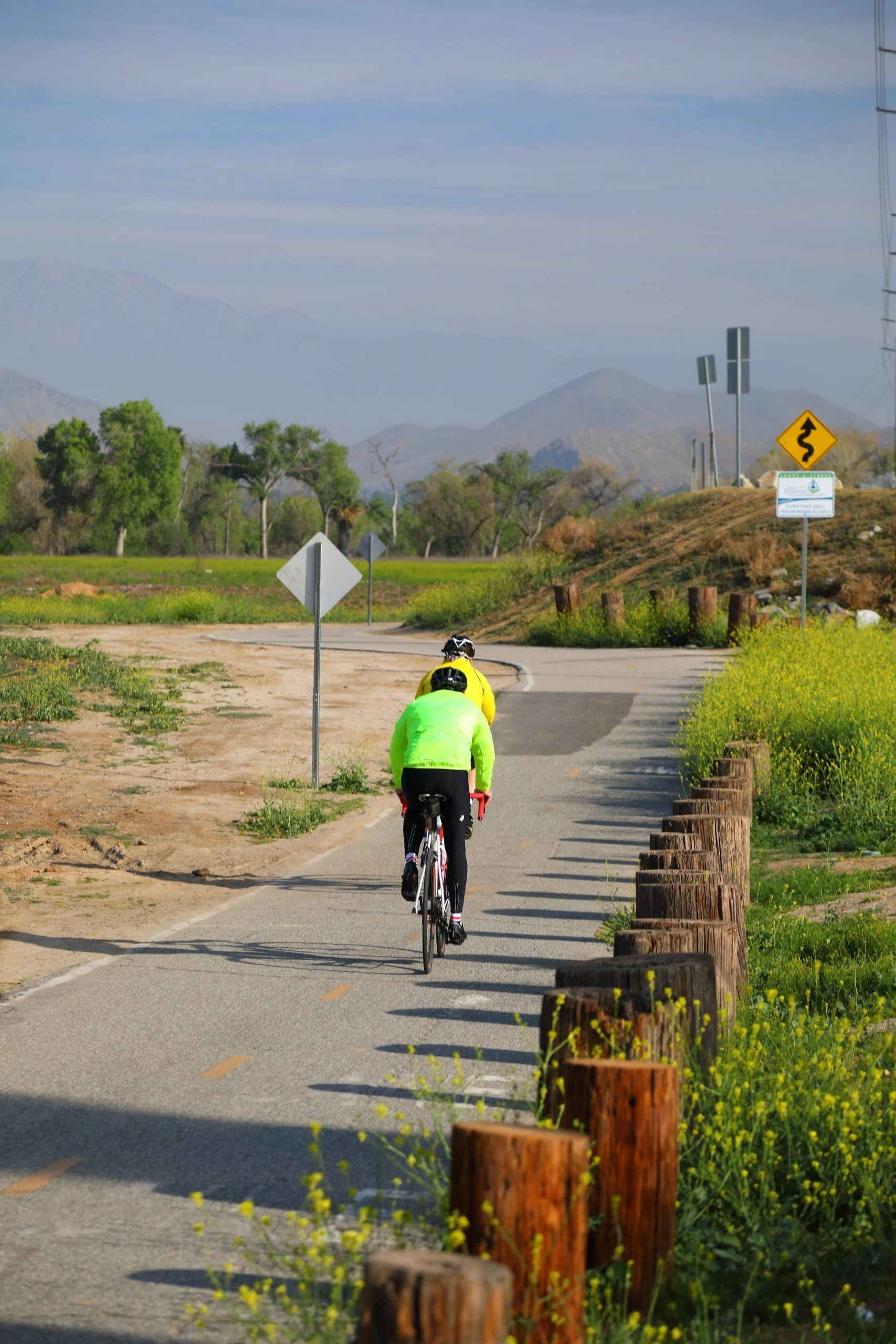
RCTC, in coordination with the Riverside County Regional Park and Open-Space District (RivCo Parks) and other project partners, is proposing the construction of a 12.8-mile section of the Santa Ana River Trail (SART). When completed, this section will provide a direct trail connection through Orange, Riverside, and San Bernardino Counties.
The proposed 12.8-mile section in the Prado Basin would promote pedestrian, equestrian, and cycling trail use with nature-viewing opportunities and provide a fully connected active transportation option for southern California. Work is planned to be completed in five phases.
The public comment period on the draft environmental documents closed on May 24, 2025.
Phase 2, 2A, 3A
- Draft Initial Study and Mitigated Negative Declaration
- Draft Initial Study and Mitigated Negative Declaration (ADA Compatible)
- Appendices
- Notice of Completion
- Notice of Intent to Adopt/Notice of Availability
Phase 3B
- Draft Initial Study and Mitigated Negative Declaration
- Draft Initial Study and Mitigated Negative Declaration (ADA Compatible)
- Appendices
- Notice of Completion
- Notice of Intent to Adopt/Notice of Availability