The Point: Salt Creek Trail opened in December; planning continues for Santa Ana River Trail segments
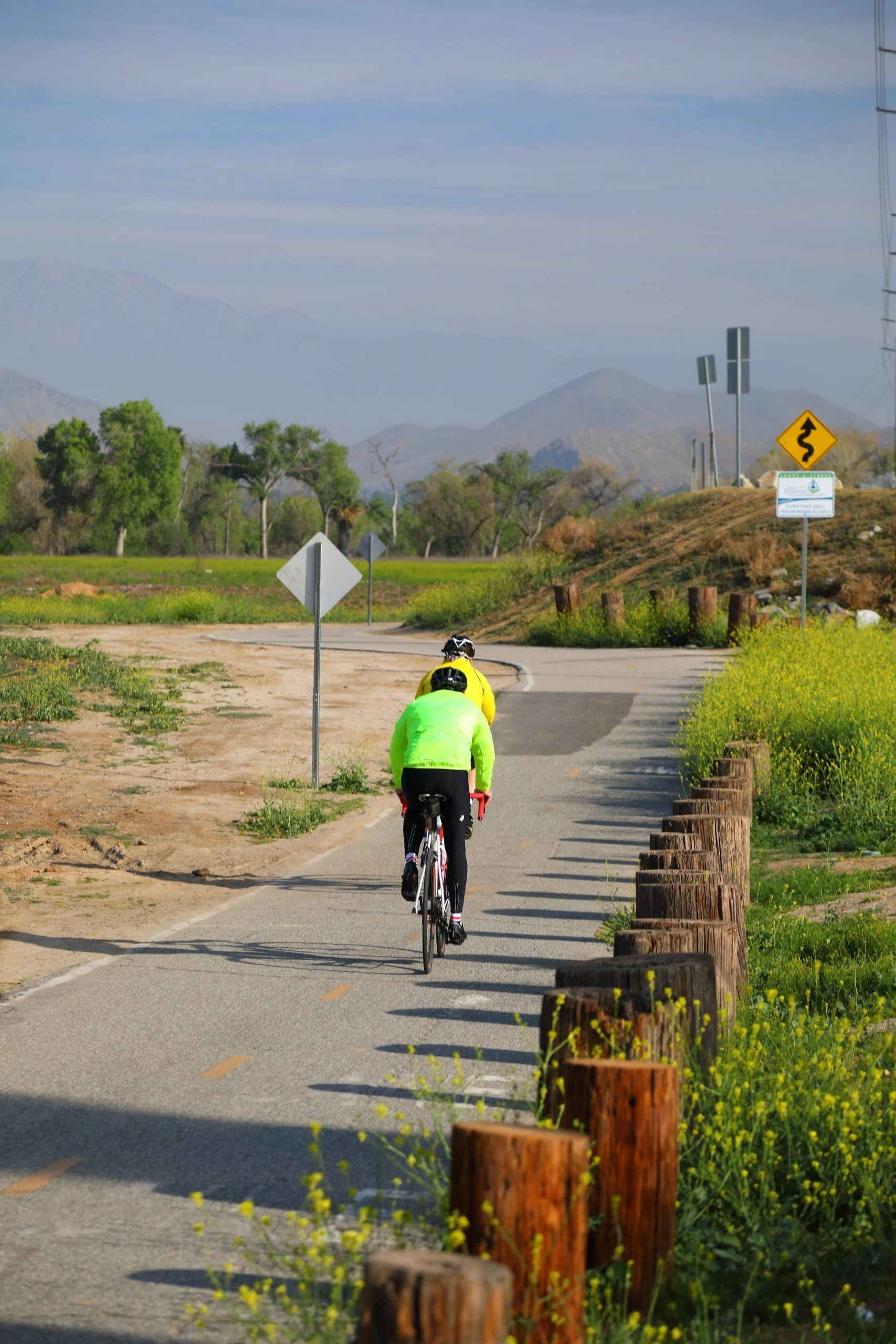
With spring on the way, it’s a great time to brush the cobwebs off your bike or running shoes and get outside for some exercise. Riverside County trails offer many options for cyclists, walkers, runners, and equestrians to explore the great outdoors.
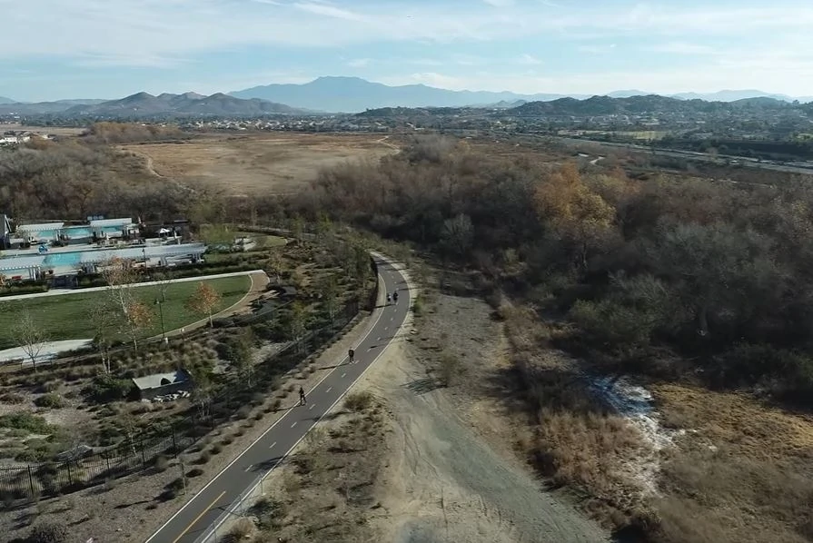
Looking for someplace new? The first phase of the Salt Creek Trail opened in late December and includes a four-mile segment along the north side of Salt Creek flood control channel between Goetz Road and Antelope Road in Menifee and a one-mile segment along Domenigoni Parkway between Sanderson Avenue and Searl Parkway in Hemet. The trail includes a hard surface Class 1 bike path and a soft surface pedestrian path.
During its meeting on March 10, RCTC approved an additional $160,000 in federal Congestion Mitigation Air Quality funding toward the total $8.1 million project, which was administered by the Riverside County Transportation Department and is now operated by the Riverside County Regional Park and Open-Space District.
In a ceremony to mark the opening of the first phase of the trail, RCTC Commissioner and Menifee Mayor Bill Zimmerman noted this “awesome milestone” and explained that the four-mile segment of the trail in his city will benefit not only residents of Menifee, but also those of Canyon Lake, Perris, Winchester, French Valley, and Murrieta.
RCTC Commissioner and Hemet City Council Member Linda Krupa voiced appreciation to the County of Riverside and its partners for completing the first phase of the trail, which she said is being used in Hemet.
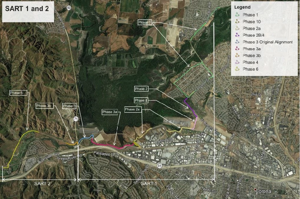
Further west, RCTC is continuing its planning efforts to expand the Santa Ana River Trail (SART), envisioned to be the longest multi-use trail in southern California, stretching 110 miles from Huntington Beach to the National Forest boundary near Mentone. RCTC is working on multiple segments to fill gaps in the SART between Green River Road in Corona to the Hidden Valley Wildlife Area east of Norco.
RCTC has been coordinating with the U.S. Army Corps of Engineers to develop a one-mile segment of the trail referred to as “Phase 4” between West Rincon Street and Butterfield Drive, just east of the Corona Municipal Airport and adjacent to Butterfield Park. Work on the trail is expected to start this fall and continue until 2023.
Longer term, RCTC is conducting engineering and environmental studies for a segment of the trail known as “Phase 6.” This two-mile phase is adjacent to the Green River Golf Club and includes portions of Chino Hills State Park with connections to the existing SART. Key features include a bridge over the Burlington Northern Santa Fe Railway tracks and a bridge over Aliso Creek to allow trail users to cross safely over the tracks and the creek. The draft environmental document is expected to be available for public comments this summer, and construction could start about two years later. This 11 million construction segment is funded by the Proposition 84 State Coastal Conservancy.
Additional Phases 2, 2A, and 3A are currently in development, several in conjunction with planned Army Corps projects. Environmental studies for these phases will start this spring. These phases include environmentally sensitive areas and the challenge of crossing the spillway of the Prado Dam and coordination with ongoing Army Corps projects in the Prado Basin. Pending the completion of these studies, construction could start as early as 2023.