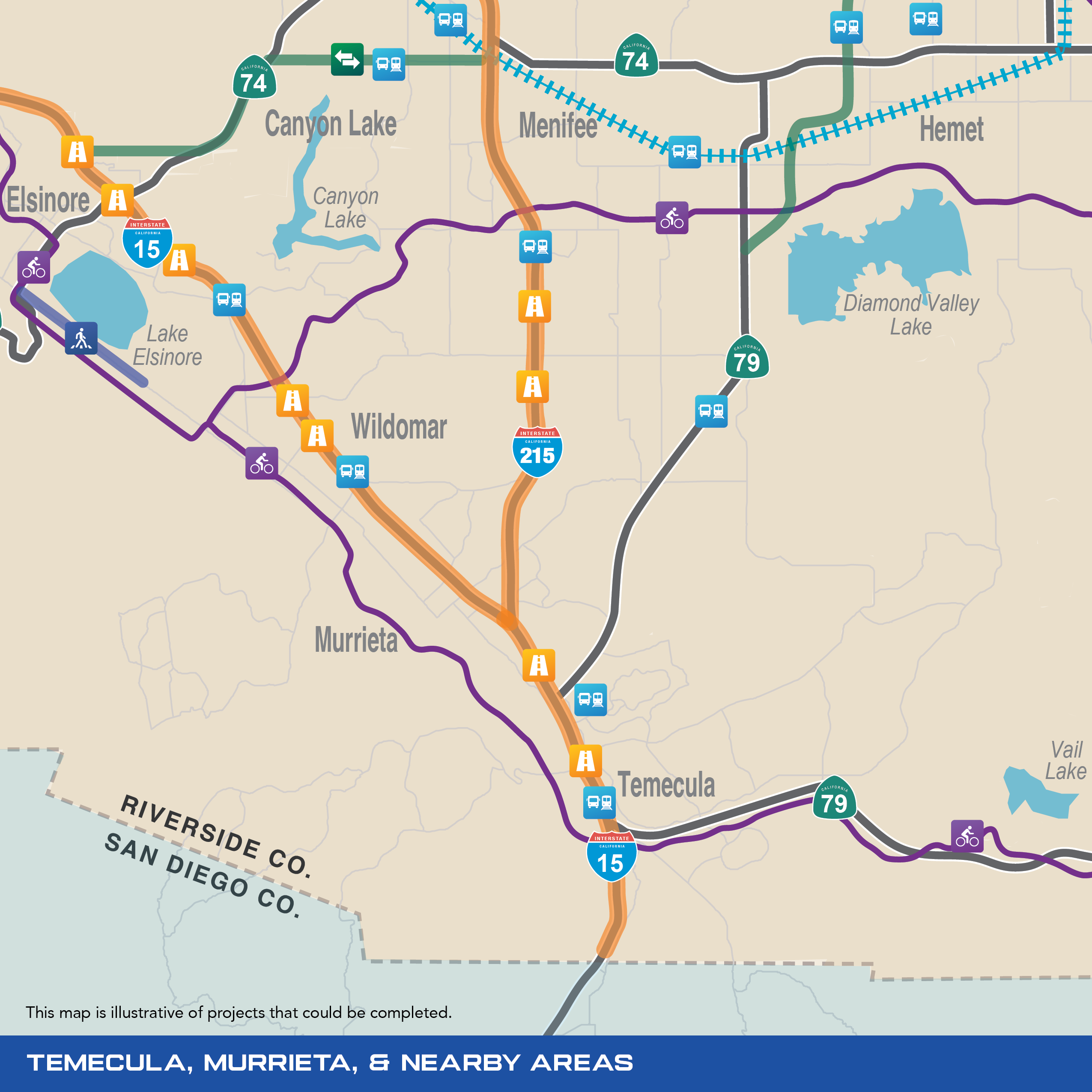
Temecula, Murrieta & Nearby Areas
The Temecula Valley region includes some of Riverside County’s fastest growing cities, from Lake Elsinore and Temecula. Existing transportation was not built for this region’s population growth. Through the TRP, residents of southwest Riverside County will see improvements to streets, highways, and public transportation.
![]()
Safe Streets & Roads
The TRP will keep roads, highways, and sidewalks safe and smooth throughout Riverside County. The plan includes a range of road and safety improvements, including fixing potholes, upgrading medians and intersections, modernizing traffic signals, and protecting infrastructure from natural hazards.
Examples of road safety and maintenance improvements include:
- Grand Avenue in Lake Elsinore
![]()
Highways
The TRP will reduce traffic congestion by completing freeway projects, improving interchanges and connections, using innovative technologies, adding new lanes, and more.
Examples of highway improvements include:
- Finishing construction on the French Valley Parkway interchange in Temecula, including:
- Widening ramps
- Constructing new on and offramps
- Adding a bridge over I-15
- Finishing the highway between Jefferson Avenue and Ynez Road
- Adding collector/distributor lanes for southbound I-15 from I-215 to Winchester Road
- Reconstructing interchanges on:
- I-15 at Nichols Road in Lake Elsinore
- I-15 at Central Avenue (SR-71 in Lake Elsinore)
- I-15 at Wildomar Trail in Wildomar
- I-15 at Bundy Canyon Road in Wildomar
- Constructing new interchanges at:
- I-15 at Franklin Street in Lake Elsinore
- I-215 at Keller Road in Murrieta
- I-215 at Garbani Road in Menifee
- Constructing new auxiliary lanes on I-215 between Murrieta and Moreno Valley
![]()
Regional Connections
The TRP will create new multimodal travel corridors that will relieve congestion, reduce commute time, and provide faster and safer alternatives to today’s limited routes.
Examples of new regional connections include:
- Elsinore-Ethanac Expressway
![]()
Public Transportation
The TRP makes a historic investment in Riverside County’s public transportation system, including by increasing the frequency and safety of trains and buses, building new tracks and stations, and adding new transit and mobility options.
Examples of public transportation improvements include:
- Studying and implementing options for new rail expansions or connections along Riverside County highway systems, including potentially on:
- I-15
- I-215
- SR-91
- SR-60
- Expanding rapid and commuter bus services to locations like Temecula
![]()
Active Transportation
The TRP makes it easier to get around Riverside County, no matter how you choose to move. It includes investments in active transportation infrastructure, including new protected bike lanes, bicycle facilities, and pedestrian safety measures.
Examples of active transportation improvements include:
- Butterfield Overland Trail/Southern Emigrant Trail
- Salt Creek Trail